A photo report has never been this quick.
When you have finished photographing, you are actually finished. No more evening at the kitchen table finding photos again, sorting them and pasting them into a document.
The screenshot and the sample report come straight out of the app. Neither was recreated for this page.
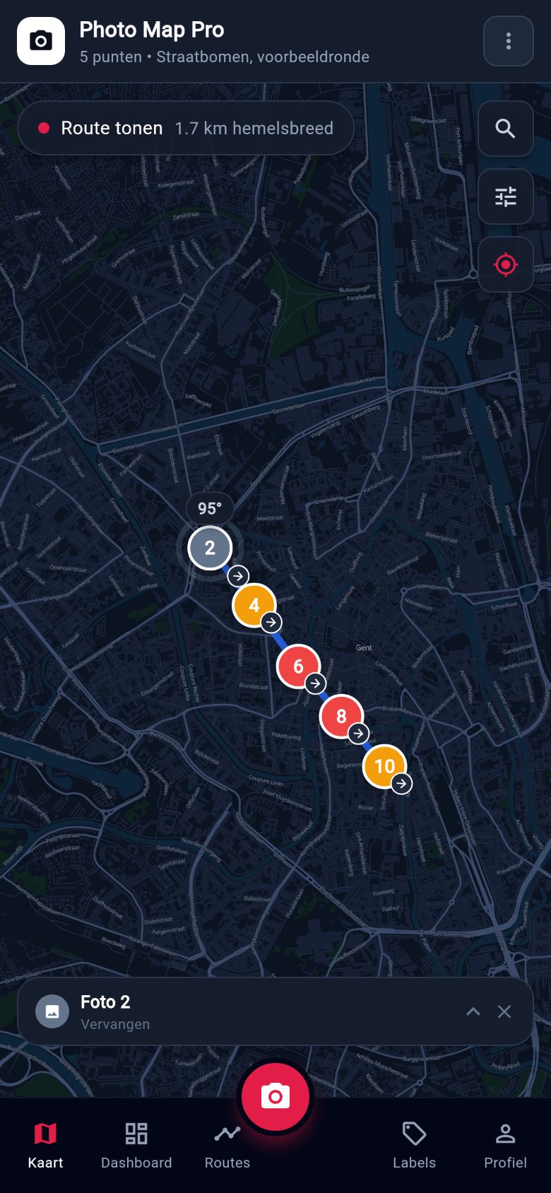
What PhotoMap Pro is
An app that is already writing the report while you record. You photograph what you see; the app remembers where you stood, which way you were facing and when it was. At the end of the round you ask for the document.
It is all already in the photo
Location, bearing, timestamp, address and category are captured with it. Working out afterwards where something was taken is no longer a job.
Works with no signal
Everything stays on the device until there is a connection again. A cellar, a tunnel or a village with no coverage changes nothing.
The report comes out the end
One click, a PDF with your logo and your name on it. Per project, per round or per task, whichever you need that day.
The old way against PhotoMap Pro
Photographing was never the problem. The problem is everything that has to happen afterwards.
How it goes today
- Photos in the gallery or in a chat group, with no context.
- Working out in the evening where each photo was taken.
- Sorting by hand, per category or per task.
- Cutting and pasting into Word or Excel.
- A second task starts the whole thing again.
With PhotoMap Pro
- Photo, location, bearing and category in one action.
- The app knows where everything is; searching does not exist.
- Sorting happens while you photograph.
- The document is laid out, not written.
- A second report is a second click.
What that is worth, for you
Put your own figures in. This works from what you enter, not from what we would like it to say.
These are your figures, not a promise from us. We do not know how long your reports take; you do. Put the desk work with PhotoMap Pro higher if you think we are being optimistic.
How it works
Three steps in the field. The rest happens while you are working.
Record
Photo, GPS location, bearing, address and category. One screen, one hand, standing in front of the thing.
Come back
Next round, same point. The app knows it is the same one, so the two visits sit side by side.
Report
One report per project, per round or per task. A PDF, or a link that expires on its own.
On screen
The explainer video is being recorded. Until it exists, nothing stands in for it here: the sample report above really does come out of the app and says more than an animation would.
The report says what changed, by itself
Two dates side by side is still a comparison somebody has to make. This one is already made: for each point the document says whether it is new, unchanged or changed, and exactly what moved.
The bearing does the work here. Two photos taken more than 25 degrees apart show a different side of the same thing. The document says so, rather than quietly putting them next to each other.
WHAT CHANGEDCHANGED
- Category: Damage becomes Replacement
- Description edited
As it appears in the PDF report.
What the DPO will ask for is already here
Geotagged photographs of public space are personal data. That comes with paperwork, and it is ready rather than still to be written.
- All data in Belgium (Google Cloud, St. Ghislain). It does not leave the EU.
- Faces and number plates permanently obscured, on the device itself.
- Shared reports expire automatically and can be withdrawn.
- An edit history that cannot be altered: who changed what, and when.
- This website sets no cookies and measures nothing. Hence no banner.
Pricing
Per user per month, excluding VAT. Annual invoicing available, which is usually simplest for a council.
- One inspector
- Cloud backup and reports
- Unlimited projects
- Shared projects
- Edit history per point
- Shared report links
- Your own branding on the report
- SSO on request
- Help with the rollout
Honest about where we are
There are no customer logos here, because there are none yet. The software works, the report above really does come out of it, and the first customer gets a pilot built around them and the attention that goes with it. If that appeals, this is the right moment to call.